Lost Islands of Prague
Every city goes through redevelopment, it’s just one of those things which comes with city life and Prague has been through it’s own share of changes. This is a post about the lost islands of Prague. It’s @1850 and there’s a new Emperor on the throne called Franz Josef. There are two road bridges across the river. Prague’s first railway station at Masarykovo Nadrazi is only 7 years old. The Jewish Ghetto has now been defined as Prague’s 5th district, Josefov. We are concentrating on the area on the riverside between the current Prague 1 and Prague 8 border which is also the border between the New Town and Karlin districts.
1850
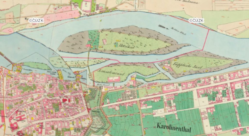
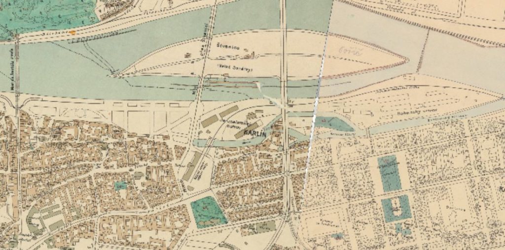
1Km from Josefov going downriver is the riverside area of Klimentska and this is what it looked like in 1850. The river is deliberately being channelled to run through a series of mills. There are five islands here.
Velke Benatky is the largest which translates as Big Venice but the locals called it Štvanice because it was connected with illegal hunting activity.
Underneath starting from the left is a small island called Primatorsky (Mayors Island) which was on it’s own until it was connected to the land via the New Mill and became property for use of the New Town Mayor.
Next on the right is a thin island called Korunni. Korunni means “crowns” and people thought it had a royal connection. More likely is a German translation error. In the 1700s the island was called “Kreninsel” which actually means horseradish island because that’s where it grew. A past error likely changed it to “Kroninsel” (German for Crown Island) or “Kronungsinsel” which was translated back incorrectly to Korunni. Next is a larger island called Jerusalem (before 1800 it had been called Vrbovy or “Willow Island” but a guy called Moses Jerusalem used it as an industrial site and the name stuck). Finally on the right the map says “Koppische” but the Czechs called it Rohan Island. There is no railway bridge and the closest road bridge is the Charles Bridge which is 2.5Km away. In 1850 you could only get to the other side of the river using a series of chain link foot bridges. The New Town is still fortified by a defensive wall that you can just see between the green and orange parts below.
1869
Twenty seven years have passed so what has changed. The mills are still working. On the far left the Emperor Franz Josef Bridge has opened (1865). Two of the Islands (Jerusalem and Rohan) have been connected to form a larger island. There is now a railway connection over the river which connects to the Masarykovo Station. The orange part is the area in Prague 8 called Karlin today.
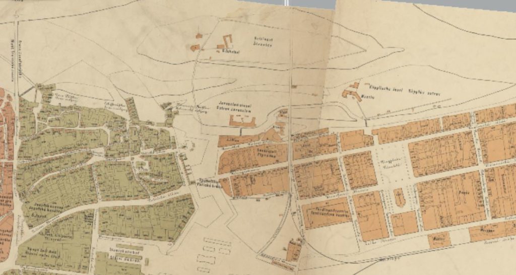
1889
Another twenty years and not much has changed except that another railway station has opened called Těšnov (1875) and the connecting railway runs through the combined Jerusalem/Rohan Island. The footbridge linking Velke Benatky with the far bank is no longer there and has possibly been replaced by a ferry. The New Town fortified wall is disappearing and will be fully demolished in the next year.
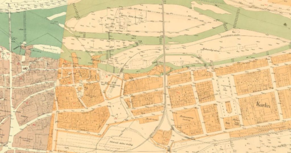
1909
Compared with 1869-89 the last twenty years have brought huge changes. All industry along the riverside has gone. The smaller islands of Primatorsky and Korunni have been completely absorbed. The Jerusalem/Rohan island has become a peninsula. Both sides of the river are now connected by the train line and a new road/tramway. The Destruction of the Jewish Ghetto is ongoing and new buildings are replacing it. The brand new railway station called Emperor Franz Josef Station had opened in 1901.
1939
Jerusalem Island is absorbed. If you are staying at the original Hotel Hilton in Prague then you are sitting on what used to be Jerusalem Island.
1969
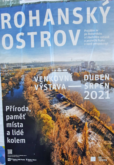
The original Koppische/Rohan Island is absorbed around this time. All that is left is a road called Rohanske Nabrezi which tells you that it used to run next to the river but in today’s river geography another part of land going up to Liben is now called Rohan Island and the poster above was advertising educational trips sponsored by the Institute for Prague Redevelopment. Check the Prague 1890 Flood post for an event which happened on this stretch of the river.
Today
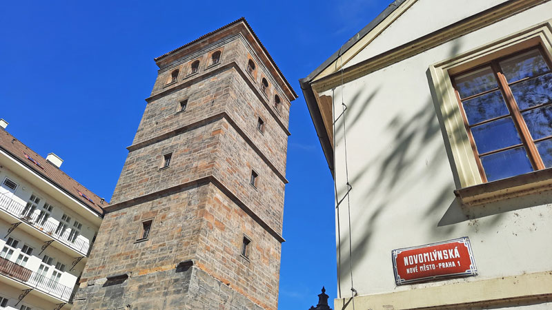
Unbelievably there is still something of the 17th Century left for us to see. The Petrske Water Tower remains as does the house next to it. The name of the street “Novomlynska” is also a clue to the history of this area as it means the “way to the New Mill” which originally connected the main land with the Primatorsky Island and the tower is accessible for tourists. Several street names in the area still refer to the locations of old mills or the names of the owners.
Map Credits: Prague Institute of Planning and Development
Something Related or a Few Minutes Away
Attraction – Slavonic Island and Sophies Palace
Parks and Gardens – Kampa Island
Services – Which Prague Hilton
My Own Guided Tours – Cheaper Than You Think!