The Prague Fords
It has always fascinated me how Prague has developed. On the walking tours I’m often asked the question about why the city of Prague originated in its current location. Anybody in the world will know the answer to this question if they understand their own geographical history. I was actually born in a town named after a certain feature. It was a shallow place to cross a river or in English, a ford. So this post is about a “lost” part of the city.

The River Changes
First consider the River Vltava. Since a series of dams were installed to the south of Prague from the 1930s this has been a managed river with a fairly constant depth and flow. But before the 1930s the river was basically left to itself so that could mean anything from flooding to running almost dry. Ever wondered why the oldest bridges like the Charles Bridge, Legion Bridge and Manes Bridge were built in their current locations?
Prague sits in a reasonably shallow basin. Upriver and downriver the Vltava becomes wider, steeper, deeper and a lot more difficult to cross. Therefore at it’s narrowest and shallowest point there developed a number of settlements on both sides of the river where for much of the year it was possible to cross between them. There were two methods 1) a ford and 2) a ferry. These settlements became popular for travellers coming to cross the river from anywhere south or east. It will be these villages and settlements that eventually join together and become what we call Prague. Crossing the river by boat was not too difficult but the heavier the goods being transported the more difficult it became. Later, people (the Old Town) made money from this difficulty by constructing a series of vehicular bridges at the narrowest point i.e. where today’s Charles Bridge stands. But before the bridges came the fords.
The Most Important Prague Fords
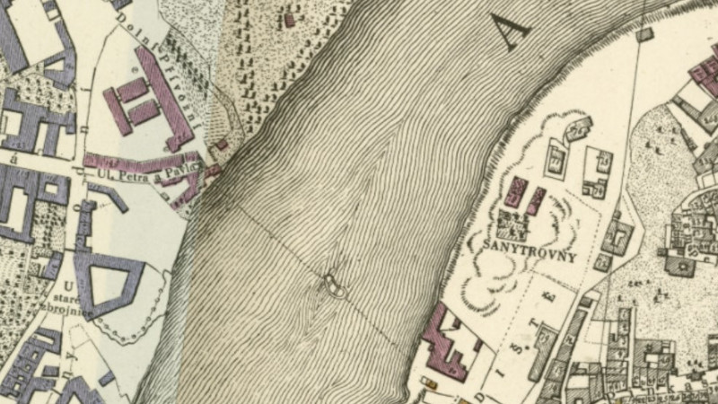
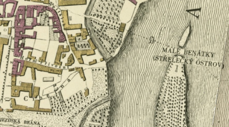
No maps exist that I have access to which show the exact location of the fords but we can pretty much work it out by looking for the ferry points. The ferry would have been upstream of the ford. There were six fords which covered an 11km stretch of river approximately from today’s Legion Bridge following the river downstream to Roztoky. The ford names were Nebovid, Vltava (also called the ford at Platnerska Street), Kaprova, Holesovice, Bubenec (may also be known as Troja) and Roztoky. A map from 1816 below shows the names of the roads that led to the ferry of the Nebovid (upper ferry) and Kaprova (lower ferry) fords.


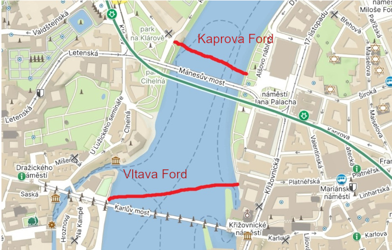
The two most important Prague Fords were located next to the Old Town just downstream of the Charles Bridge a mere 300 metres apart. The two central fords would have connected to streets that led directly to the Old Town Square. The oldest was the Vltava Ford which connected the present day Platnerska Street with the Lesser Town. The other, less than 200 metres further downriver, is now referred to as the “Kaprova Ford” although this would not have been the original name. The Kaprova Ford connected the Old Town with the settlement on the other side of the river called Písek. A third ford, the most upstream, was called the “Nebovid” and linked both sides of the river just inside the fortified areas of the Old Town and the Lesser Town.
The Lesser Town side of the Charles Bridge sits at the end of what was the Vltava Ford. The Kaprova Ford was replaced by an Iron Footbridge which was itself removed after the construction of the Manes Bridge. The Nebovid Ford was eventually replaced by the Legion Bridge.
Something Related or a Few Minutes Away
History – The Lost Islands of Prague
Activity – River Cruise Review
