Prague Tourism Sign Posts
In the age of Google Maps you’d be forgiven for thinking that physical sign posts planted in the ground is all a bit 1990s. But once you get used to what they show you they are a useful aid to exploring the city especially if your data connection breaks. So you’re new to the city, you’re old-school and you’ve got your trusty map in your hand deciding which way to go. It’s good to understand Prague Tourism Sign Posts.

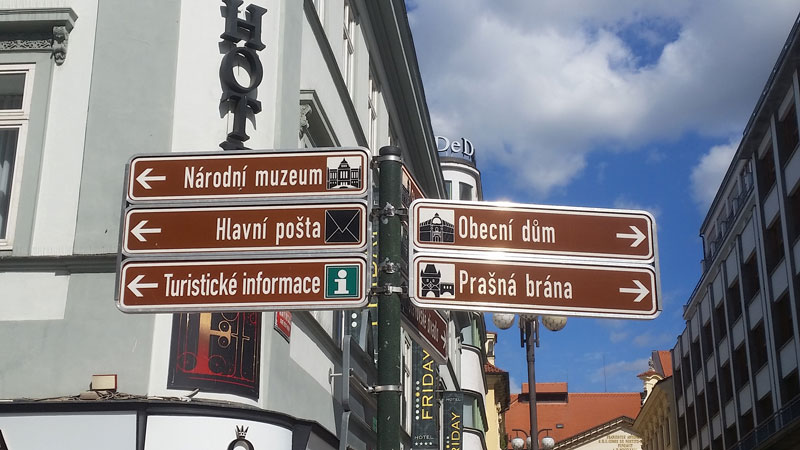
For example, the sign above is telling me that if I turn to my left I have a tourist information centre somewhere in that direction, the main post office and the National Museum. If I turned to my right that takes me to the Powder Gate and the Municipal House.
So looking at the picture above two things will jump out. 1) The signs are brown and 2) The signs are in Czech. There are four other things to note. Firstly it assumes that you are walking so the signs won’t show any restrictions for bikes etc. Secondly you have to know the name of the location or attraction in Czech (most guidebooks would tell you both). Thirdly, if it’s an attraction it will have a little graphic next to it showing a generic sketch of the attraction. The official Prague city tourist maps from the information centres have the same graphic. Lastly, it will not tell you how far something is located.

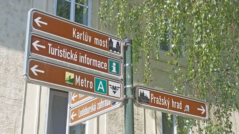
Here is another example of Prague Tourism sign posts at the end of Valdstejnska. Two of Prague most famous attractions. Karluv Most is Charles Bridge and Pražský Hrad is Prague Castle. The sign also says your closest metro station is on the “A” line and that there is a Tourist Information centre (note the “i” signs always direct you to the closest large square).
Treat these signs as taking you “in the direction of” whatever it says. It might not be the fastest route but it’ll get you there. If there is a sign to a metro station then it usually gives the line i.e. a green box with the capital letter A, a yellow box for B and a red box for C.
